So, You know roughly what we’re looking for but how do you find them? The best ways of finding them or the preferred way of finding them is via an Ordnance Survey Map but there are others :
- Local Council/Parish ROW maps either online or offline.
- The Definitive Map (DM) & Statement (Only applies to BOATS)
- The Local List of Streets (LoS)
- or if your a member (Highly recommended) via Trailwise which is provided by The Green Lane Association
For this tutorial we’re going to be using the most Excellent Bing Maps from Microsoft that provide free OS mapping, an alternative to this which works offline and comes highly recommended is Memory Maps, which you can get on your phone/pc/tablet and allows you to share routes.
So let’s check out how to use Bing’s maps for now so we can start searching.
Click here : https://binged.it/2qpCTkl
You will see the view in fig.1 (You may need to adjust slightly dependent on screen size) click up in the top right corner (Highlighted) on where it say’s Road.
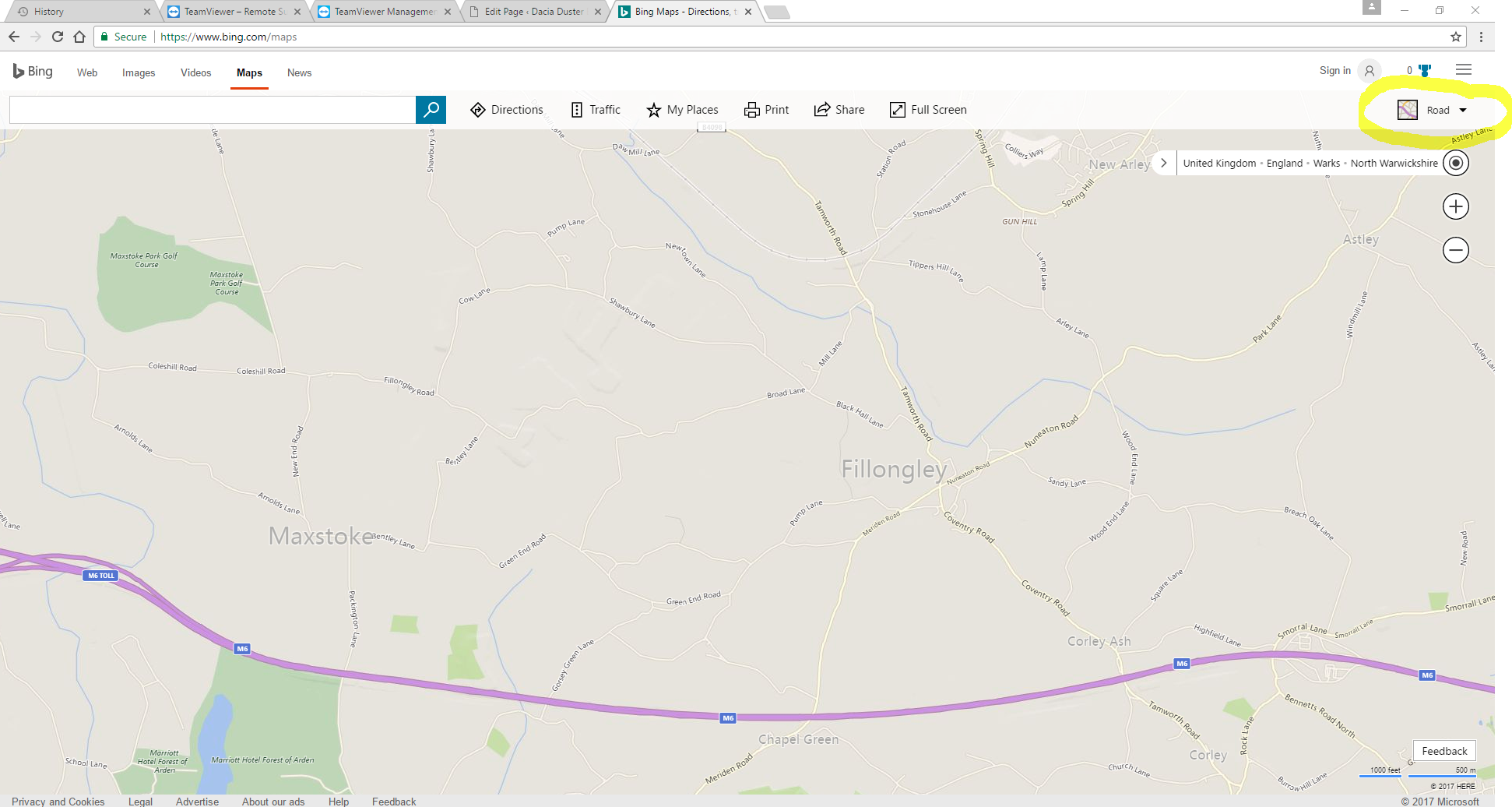
Fig. 1 – Bing Map Road View
Now click the Ordnance survey view as shown in fig 2 you’ll see the map change as shown.
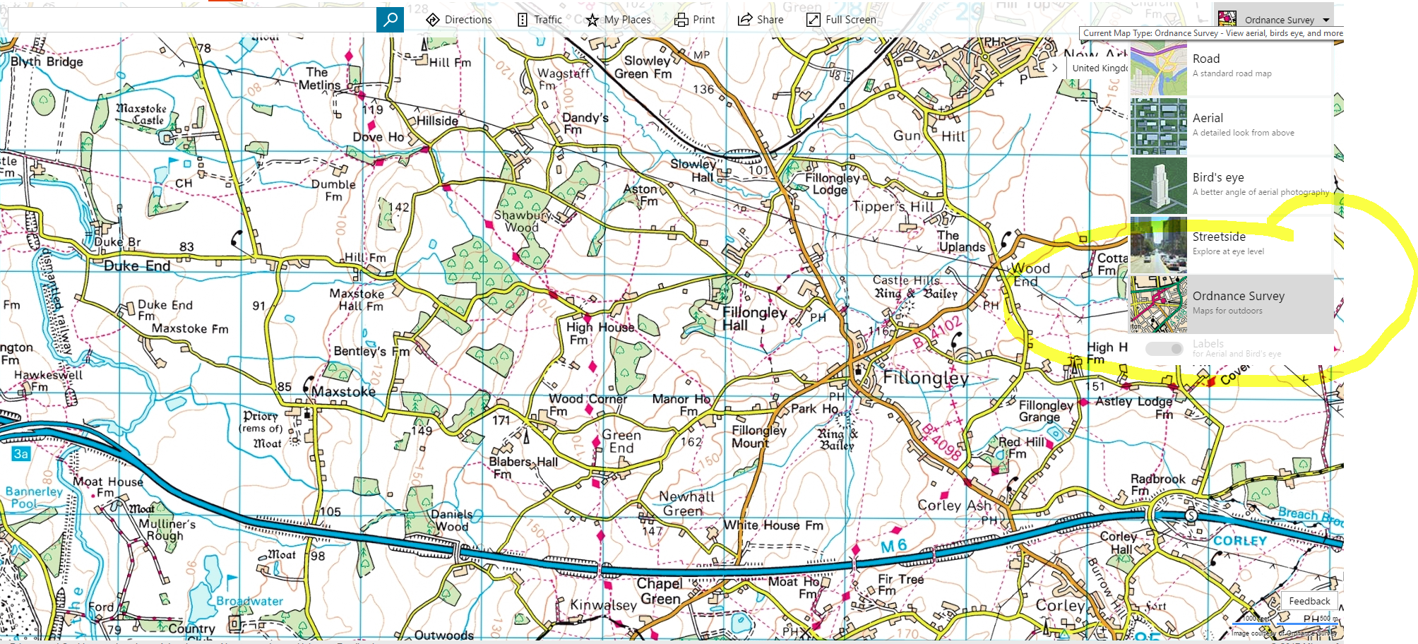
Fig. 2 – View Options
If you press the + button to move in one step and centre your screen so that Fillongley sits in the middle as per fig 3.
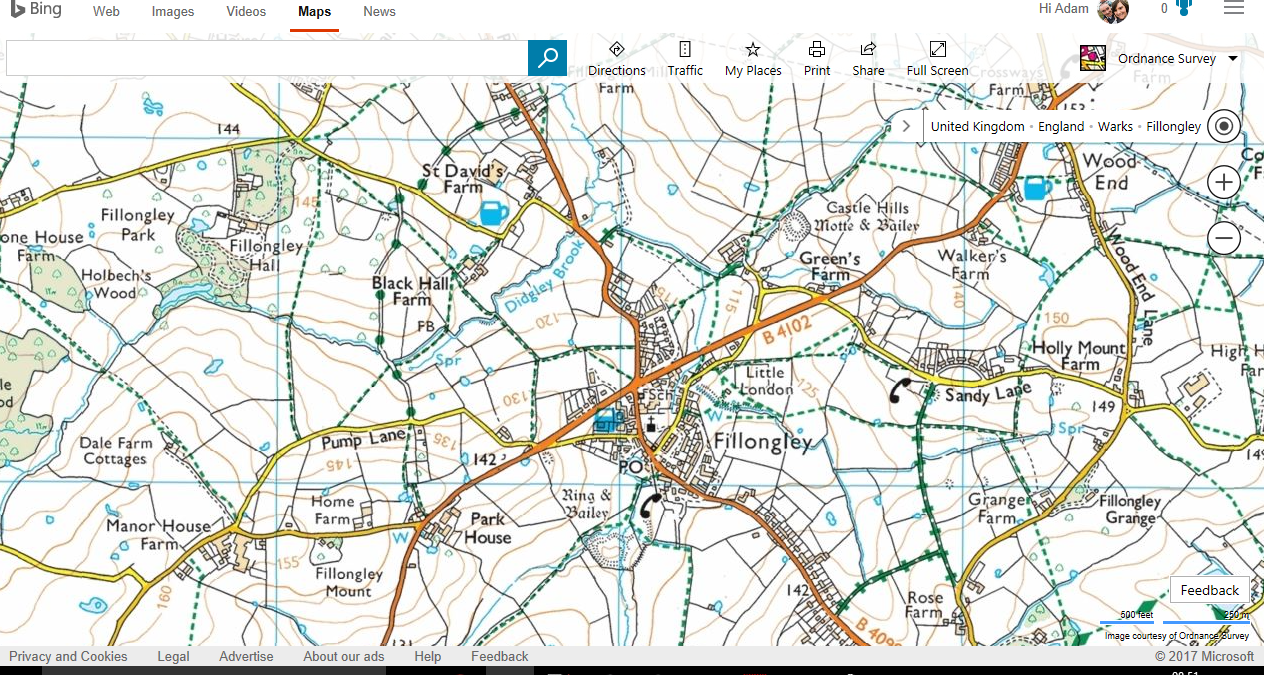
Fig. 3 – Zoomed in view
In fig 4 I’ve highlighted and numbered 4 areas of interest, So imagine that you’ve browsed the map and discovered these lanes, 1 and 2 are Other Roads with Public Access (ORPA) and 3 and 4 are Byways open to All traffic (BOAT) according to the legend for an OS map at this detail level 1:25.
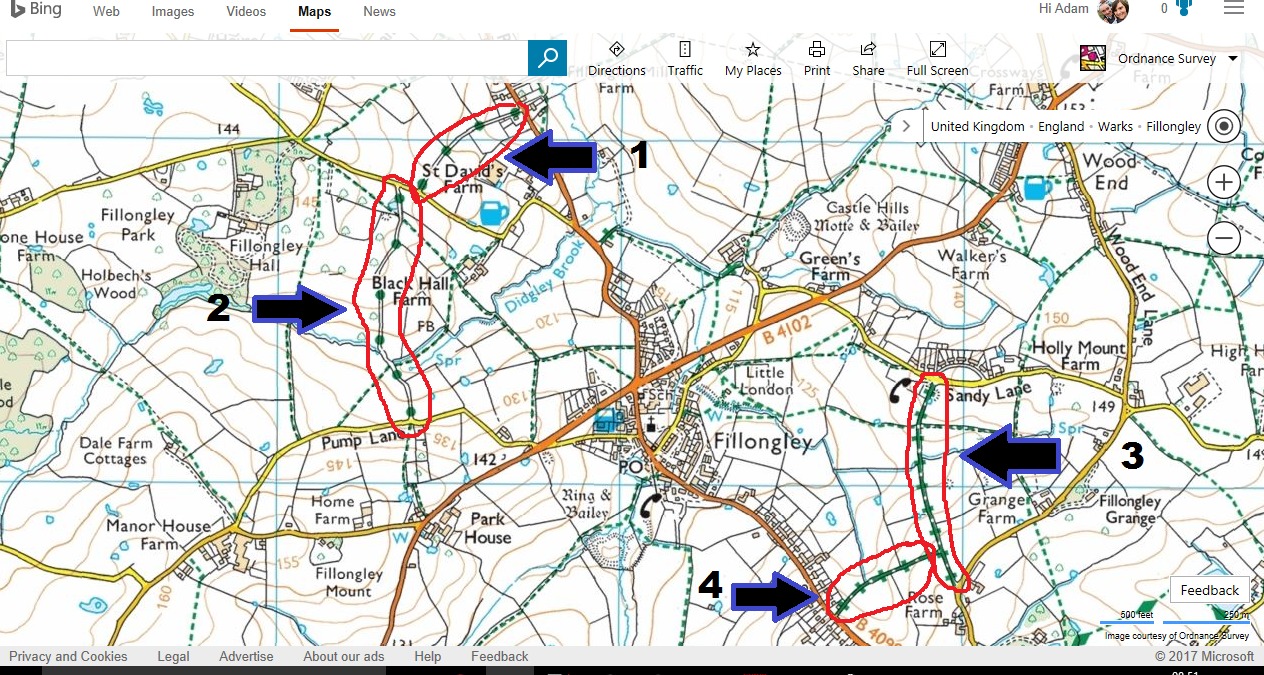
Fig. 4 – Highlighted and Numbered ‘Green Lanes’
But are they open to vehicles? Well if you followed the map then the map is indicating that they are indeed open to vehicles but to be truly sure you need to contact your local council and ask (as maps can be out of date and routes can be temporarily closed using Temporary Traffic Regulation orders (TTRO sometimes abbreviated to TRO) or Stopped up which means it’s no longer a road at all and therefore you cannot drive it or walk it etc. or simply a Permanent TRO (PTRO), To do this right click at the start of one of the routes in fig 5.
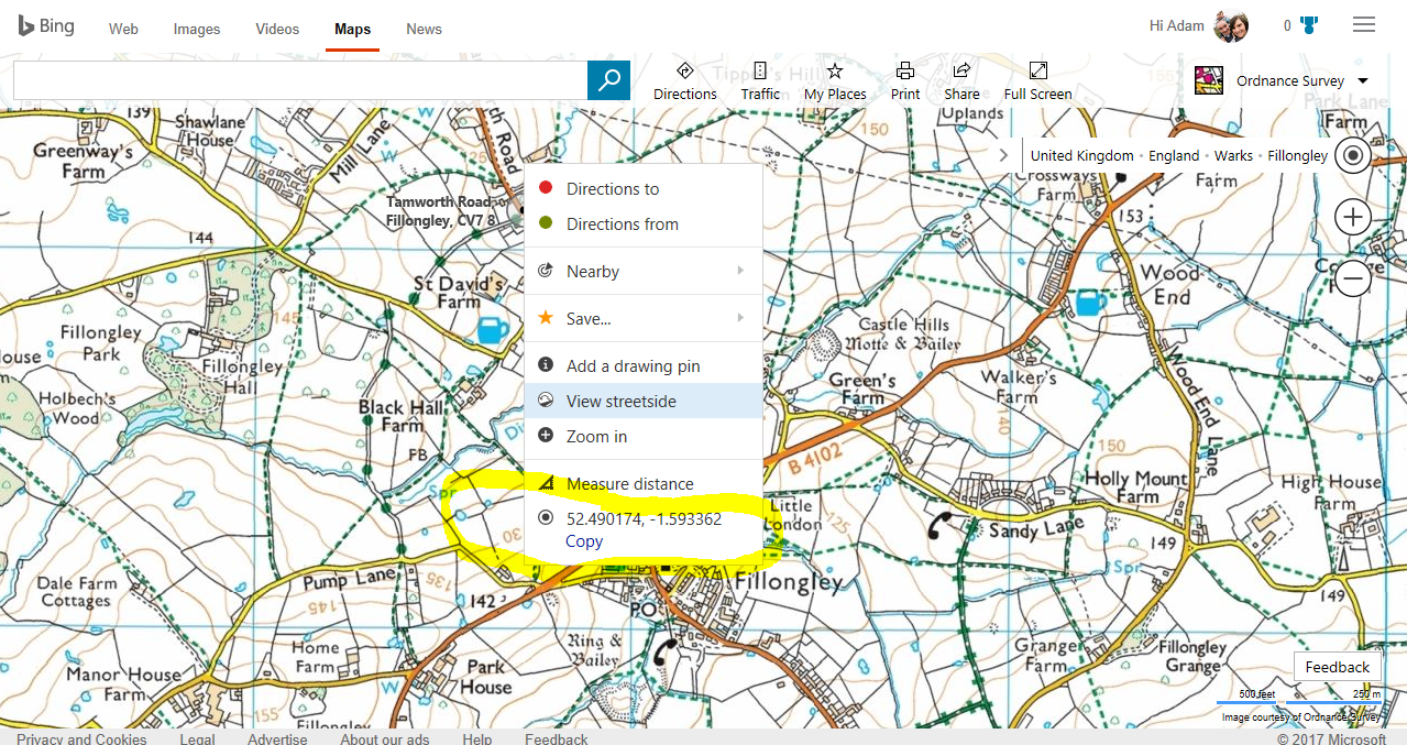
Fig. 5 – Context menu when right clicking on Map screen
I’ve chosen the start of route 1 and then note down the numbers or select the copy option to paste into an email, you’ll then need to do the same for the end of the route. Then all you need to do is ask the council if the lane is open and not subject to any TRO’s between the start XX and XX end coordinates, you can usually do this via email/website/phone although it’s preferred to ask via the website or email so you have a hard copy of any evidence should you have an issue on the lane, of course this is why we advise being a member of The Green Lane Association as they have rep’s that can do this for you and or advise you on the conditions of the road before you set out, I myself (Adam) work for the Green Lane Association as a Rep for Warwickshire.
So, the emails/calls have come back that these routes are indeed open is that it?
No… the councils won’t tell you the state of the road etc so it’s your ‘explorer’ instinct to go check them out!